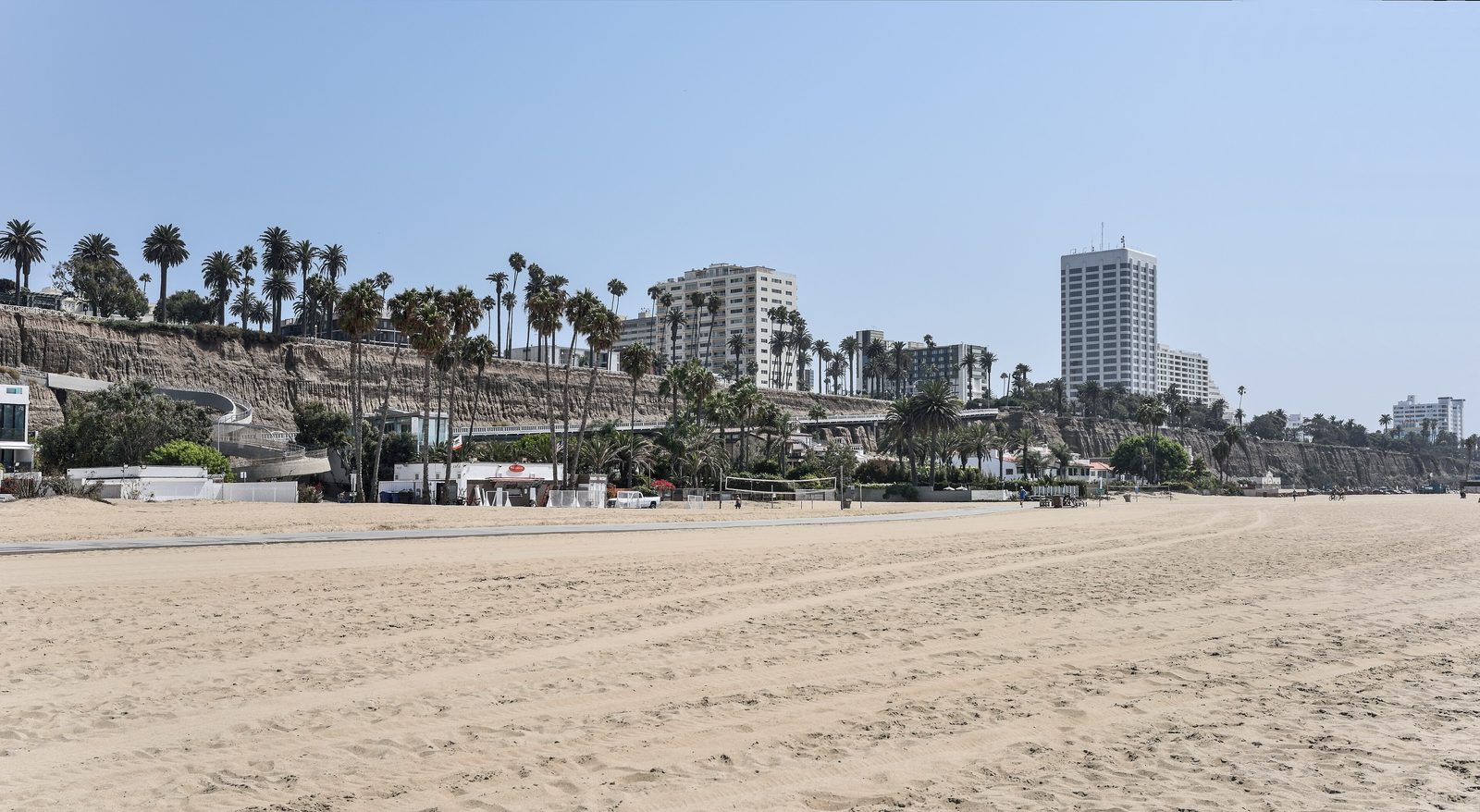

On January 27, 2026, Heal the Bay expanded its usual monitoring into an hour-by-hour study of the water around Santa Monica Pier. The nonprofit reports that its team sampled three stations over 16 hours; the aim was to find changes across place and time that weekly testing can miss. The campaign anchors a new multi-agency inquiry into a problem that has resisted decades of engineering.
The water directly beside the pier had just completed another dismal year. Heal the Bay’s 2025–26 Beach Report Card ranked it second among California’s ten poorest summer-dry locations. It was the pier’s second consecutive year at No. 2, its fifth consecutive appearance on the Beach Bummer list and its fifteenth appearance in twenty-one years. The sampling station received F grades in summer dry weather, winter dry weather and after rain.
That record is especially conspicuous in a state where 91 percent of monitored beaches still earned A or B grades during summer dry conditions. It is also easy to misunderstand. The failing grade belongs to water sampled at the pier, not to every stretch of Santa Monica State Beach. Nearby locations have often performed much better.
The distinction can be measured in hundreds of feet. Its history reaches back more than a century.
Today’s Santa Monica Pier is actually two adjoining structures. The long, narrow Municipal Pier opened on September 9, 1909, after the city approved a $150,000 bond and commissioned a 1,600-foot concrete structure carrying an 18-inch pipe. Its primary purpose was unglamorous: take treated sewage beyond the breakers so the outfall would not foul the beach.
Seven years later, amusement entrepreneur Charles Looff built a wider Pleasure Pier beside it. His pier offered a carousel, ballroom, bowling and billiards hall, roller coaster and other diversions designed for a population escaping inland heat. Municipal plumbing and public pleasure stood side by side until visitors came to experience them as one landmark.
The pleasure half eventually won the skyline. The Ferris wheel, carousel and arched entrance became the picture people carried home. The pier’s origins in water infrastructure faded beneath the rides.
The old sewage outfall does not explain today’s bacteria. The present problem belongs to a different system—one involving urban runoff, birds, damp sand, stormwater infrastructure and the way water circulates around the pier and the remains of its breakwater. Scientists are still determining how much each source contributes.
Indicator bacteria can show that water poses a health risk. They cannot, by themselves, name the source.
That distinction matters. Fecal-indicator bacteria are used because elevated concentrations correlate with a greater risk of gastrointestinal illness, rashes, ear infections and respiratory problems. Their presence does not automatically prove that human sewage is in the water. The bacteria may originate with people, birds or other animals; they may arrive through runoff or persist in moist sand.
A 2017 Water, Air, & Soil Pollution paper led by Kathryn Mika compared sand beneath the pier with adjacent samples. Across seasonal surveys, indicator-bacteria concentrations were consistently higher under the structure and rose with moisture. In a separate one-day source-tracking snapshot, the team detected a gull-and-pelican marker at eight of 12 sites and neither of the two human-associated markers it tested. The results support birds and long persistence in damp sand as contributors. They do not rule out intermittent human inputs at other times.
Santa Monica has pursued one partial answer after another. The city has repaired sewers, redirected fish-cleaning sinks, covered trash, diverted dry-weather runoff, replaced stormwater infrastructure and installed netting to keep birds from roosting beneath the deck. A major capture project completed in 2018 included a 1.6-million-gallon underground tank collecting runoff from more than one hundred downtown acres.
Some interventions coincided with temporary improvement. None settled the larger question. Bird netting installed beneath the pier later deteriorated. Bacteria levels rose again.
Scientists have also begun studying something less visible than a drain or a bird: the movement of the ocean itself.
UCLA and The Bay Foundation used fluorescent rhodamine dye in September 2025 to trace circulation around the damaged Santa Monica Breakwater. UCLA’s project account says the study asked how the structure redirects water and whether that movement helps explain persistent poor readings near the pier. Built in 1934 for a yacht harbor and reduced by later storms, the breakwater no longer shelters a marina, but it still changes waves and current.
The January sampling campaign continued that investigation from another direction. Instead of following the water, Heal the Bay’s scientists are examining what the water carries. Microbial source tracking can distinguish bacteria associated with humans, birds and other animals. Hourly sampling can reveal changes hidden by a single weekly result. Historical data can show whether those changes repeat across seasons and years.
The Santa Monica Pier Water Quality Task Force plans to bring those strands together: decades of monitoring, previous engineering projects, microbial evidence and circulation studies. Its first comprehensive public report is expected in fall 2026.
For swimmers, the science produces a simpler distinction. An annual report card describes the long-term character of a location. A county warning describes the most recently tested conditions. A posted sign on the sand applies to the water in front of it. None should be substituted for another.
The pier can still be the place for the carousel, fishing rail and sunset photograph. The swim requires a separate decision made from that day’s county map, the signs on the beach and the advice of an open lifeguard tower.
More than a century ago, engineers carried the city’s treated waste seaward beneath these boards. This winter, scientists carried bottles of surf back across them, searching for the source of what keeps returning.
Above, the pier has become exactly what the pleasure builders intended: an attraction visible for miles. Below, the water is still being read.
Before you swim
Current conditions checked August 14, 2026
Los Angeles County’s latest posting advised against ocean contact within 100 yards in either direction of Santa Monica Pier and the East Wilshire Boulevard storm drain near North Tower 12.
- Check the current Los Angeles County advisory map on the day you visit.
- Move completely beyond every posted warning zone; walking exactly 100 yards may only bring you to its boundary.
- Avoid ocean contact during rain and for at least 72 hours after it ends—longer if an advisory remains active.
- Avoid flowing storm drains, creeks and water ponded on the sand.
- Swim near an open, staffed lifeguard tower and ask where conditions are safest that day.
- A water-use warning restricts contact with a specified area of water. It does not necessarily close the surrounding sand.
Sources and further reading
- Heal the Bay, “Santa Monica Pier’s Water Quality Mystery and New Task Force,” July 17, 2026: healthebay.org
- Heal the Bay, 2025–26 Beach Report Card: healthebay.org
- City of Santa Monica, “Santa Monica Pier”: santamonica.gov
- Santa Monica Conservancy, “Santa Monica Pier”: smconservancy.org
- Los Angeles County Department of Public Health, beach advisory map: publichealth.lacounty.gov/beach
- Los Angeles County Department of Public Health, beach signs and rain advisory: publichealth.lacounty.gov
- Christine Wei-li Lee, “Santa Monica’s waves will run pink during UCLA water quality test,” UCLA, September 10, 2025: newsroom.ucla.edu
- The Bay Foundation, “SMBNEP Collaborators — Santa Monica Breakwater”: santamonicabay.org
- Kathryn B. Mika et al., “Sources and Persistence of Fecal Indicator Bacteria and Bacteroidales in Sand…,” Water, Air, & Soil Pollution 228, 124 (2017), DOI 10.1007/s11270-017-3291-y: PMC6404519
From the journal
Related stories
Place
Two oceans, two answers
Los Cabos
At Land's End you can stand on two oceans in a few steps.
Nature
The mountains under your feet
Siesta Key
Siesta Beach’s powder began as Appalachian rock.
Place
The hinge
Gulf Shores / Orange Beach
You pick Gulf Shores or Orange Beach as if those were two beaches.