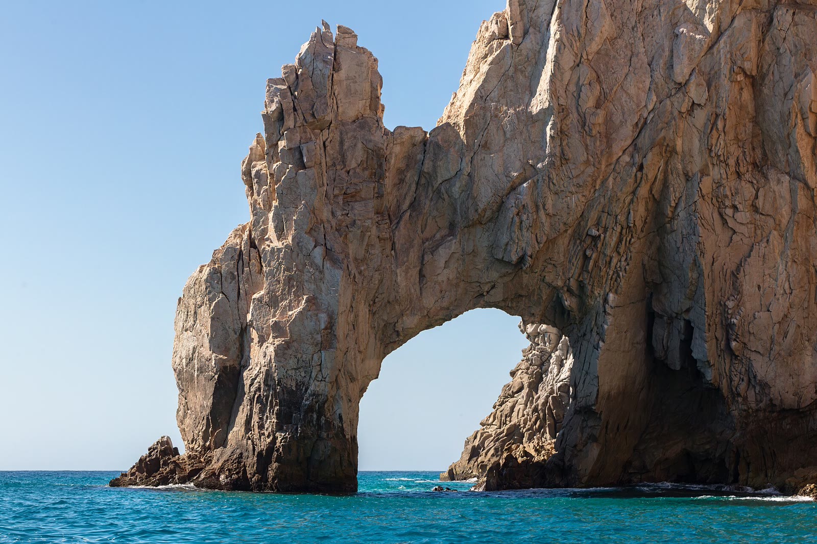

On August 3, 2026, Los Cabos authorities closed Playa del Divorcio and posted a black flag. A temporary bank of sand had made it possible to walk beneath El Arco, and images of the passage were drawing visitors. The timing was dangerous. Long-period Pacific swell was reaching Land’s End, and the route ended on a beach exposed to powerful surf.
Civil Protection’s warning was practical rather than picturesque: irregular waves could carry a person seaward from a place where rescue would be difficult. From shore, the arch looked newly passable. The official signal said otherwise.
El Arco makes motion look permanent. It stands like a stone period at the end of the Baja California peninsula, and tourism has built an equally tidy sentence around it: this is where two oceans meet.
The sentence is memorable—and one ocean too many.
The Gulf of California, also called the Sea of Cortez, is a long, semienclosed sea connected to the Pacific—not a second ocean. The International Hydrographic Organization draws its southern limit along an imaginary line from Baja’s southern extreme toward Punta Piaxtla on the Mexican mainland. Charts need a boundary; the water does not arrange itself into one.
At the gulf’s broad mouth, oceanographers measure Gulf water, California Current water and tropical surface water in proportions that shift with season, wind and eddies. The meeting occurs across depth and distance; no fixed seam runs beneath the arch.
On the sand, however, the contrast is immediate. Playa del Amor faces into Cabo San Lucas Bay, with the granite mass of Land’s End between it and much of the open Pacific. The local tourism board lists swimming and snorkeling there when conditions permit. Cross the sandy neck and the coast turns toward the ocean. Playa del Divorcio receives far more direct swell, with powerful breaking waves and strong currents; official guidance is unequivocal about staying out of the water.
The water has not changed identity; its exposure has.
Modern tourism pages circulate an eighteenth-century tale about a local woman who rescues a Japanese sailor, loses him to her father’s violence and dies on the neighboring beach. The versions provide no names, vessel, firm date or traceable archival citation, and some shift the period. The story may explain how guides narrate the paired names; it should not be presented as their established origin.
The archive offers better stories.
Before Spanish charts called this San Lucas, the cape lay in Pericú country. Historical place-name records preserve Yenecamú for Cabo San Lucas, and early visitors recorded Pericú mariners using wooden rafts here. Only fragments of the language survive. The tourism-friendly translation “place between two waters” is tempting, but scholarship securely supports the name, not that neat English gloss.
In November 1587, the English privateer Thomas Cavendish captured the Manila galleon Santa Ana off Cabo, stripped its cargo and tried to burn the ship. His expedition later included two young Japanese men identified in the English record as Christopher and Cosmus.
That episode does not explain the beach names. Read beside the Pericú record, it establishes something more consequential: the cape marketed as a dividing line was already a corridor through which people, cargo and empires moved.
The geology resists a tidy caption, too. Land’s End belongs to the Los Cabos block, a mass of Mesozoic crystalline rock at the peninsula’s tip. The basement reaches back into the Cretaceous, but the opening in El Arco does not carry the same birthday; it is a younger erosional form cut into older stone. Sand gathers at its feet, disappears and gathers again. The rock is ancient; the silhouette remains under revision.
Mexico’s original 1973 protection recognized that the important landscape continued below the surface. The federal decree called Cabo San Lucas a “submarine refuge of flora, fauna and ecological conditions of the seabed”; the area was recategorized in 2000 as the Área de Protección de Flora y Fauna Cabo San Lucas. CONANP now lists sea lions, humpback whales, marlin, olive ridley turtles and leatherbacks among its representative species. El Arco is the famous part above water, not the whole place.
The practical lesson travels beyond Land’s End, but it is not the old binary of Pacific bad, Sea of Cortez good. Orientation, shelter, seabed and the day’s swell all matter. Médano sits inside Cabo San Lucas Bay; Chileno, Santa María and Palmilla occupy coves that are often suitable for swimming. Storms and mar de fondo can close every one of them.
A Blue Flag answers questions about environmental management, water quality, safety provisions and services. It cannot report the next set of waves. The colored flag posted by local authorities answers the immediate question: green for suitable conditions, yellow for caution, red for no entry, black for closure. A beach’s reputation provides context; the morning’s flag makes the decision.
The temporary passage beneath El Arco will be rearranged, and the opening will frame water again. Photographs will preserve a doorway the coast has already withdrawn. Land’s End looks like the place where geography stops; its more durable history is passage.
Before the boat leaves
- Access: The usual trip to Playa del Amor is by water taxi or tour boat from the marina or Médano; kayaks and paddleboards also make the crossing in suitable conditions. Confirm the landing and return plan before setting out.
- Swimming: Playa del Amor can be suitable when local conditions permit. Playa del Divorcio is not a swimming beach.
- Facilities: CONANP says the protected area has no visitor infrastructure of its own. Carry water and sun protection, and take everything back out.
- Flags: At monitored beaches, green means suitable, yellow means caution, red prohibits entry and black closes the beach. Follow lifeguards and municipal authorities even when a beach is normally calm.
- A steadier swim day: Médano, Chileno and Palmilla have monitored areas, but only the conditions posted that day determine whether to enter.
Sources and further reading
- Ayuntamiento de Los Cabos, “Restringe Ayuntamiento acceso a Playa del Divorcio por riesgo extremo en El Arco,” August 3, 2026: loscabos.gob.mx
- International Hydrographic Organization — Limits of Oceans and Seas
- Ciencias Marinas — water masses and circulation at the Gulf of California entrance
- Visit Los Cabos — Lover’s Beach and swimming safety
- UNAM — the fragmentary Pericú language record
- Don Laylander — historical evidence for Pericú maritime life
- Richard Hakluyt — near-contemporary account of Cavendish’s 1587 voyage
- CaboSanLucas.net, “Lover’s Beach” (example of the modern legend): cabosanlucas.net
- El Siglo de Torreón, modern beach legend (example of the modern legend): elsiglodetorreon.com.mx
- Fletcher et al. — geology of the Los Cabos block
- Diario Oficial de la Federación — protected-area history
- CONANP — Cabo San Lucas protected area
- Blue Flag — certification criteria
- Los Cabos municipality — beach flag meanings
From the journal
Related stories
Place
The postcard is not the swim
Santa Monica–Venice
You typed Santa Monica Beach and landed on the pier. That is the picture.
Place
The hinge
Gulf Shores / Orange Beach
You pick Gulf Shores or Orange Beach as if those were two beaches.
Oddities
The Tybee Bomb
Tybee Island
A Mark 15 went into the water in 1958 and never came back up.