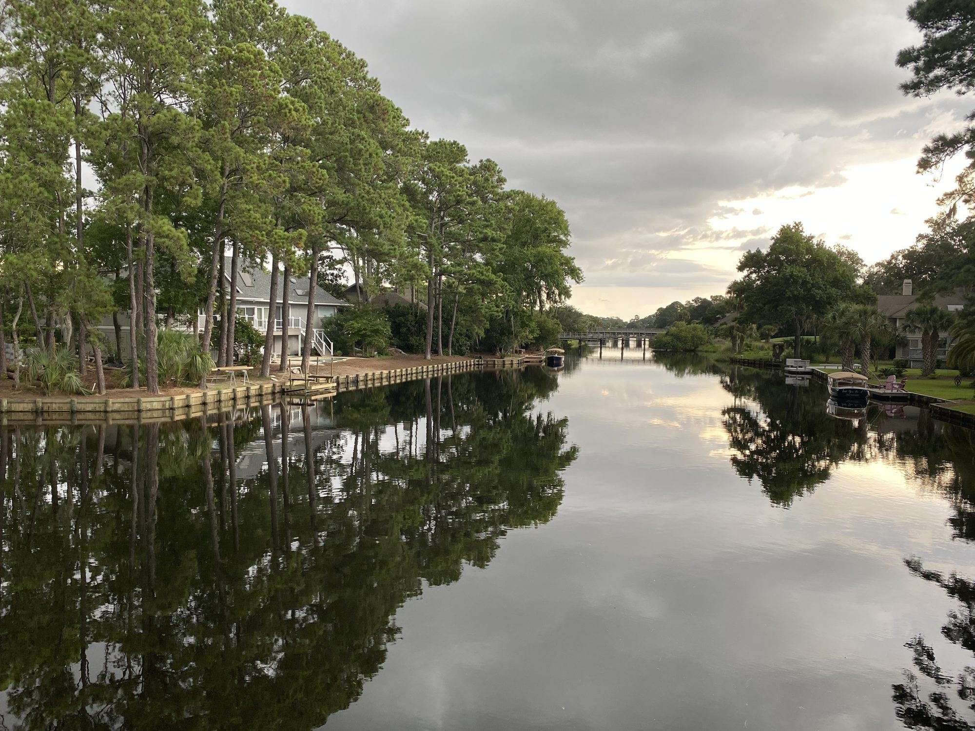
On a map, Palmetto Dunes looks as though a tidal creek wandered through the resort and the roads politely bent around it. The opposite is closer to the truth.
The water followed a plan.
Around the turn of the 1970s, the developers of this middle stretch of Hilton Head Island faced a problem with two addresses. Along the Atlantic, three miles of beach were so low and narrow, resort histories say, that high tide nearly erased them. Inland, flat and waterlogged ground needed somewhere to drain.
Per Bruun, a Danish coastal engineer whose work centered on beaches and inlets, treated the inland drainage problem and the eroding shore as one system. In the history published by the Palmetto Dunes Property Owners Association, he described the canal as the answer: excavate the interior, pump the spoil toward the ocean and use it to build beach and dune. Work began with a dredge weighing about 100 tons; crews sent the material through pipes to the Atlantic frontage for grading.
The scale is easier to understand from the air: a dark, branching waterway on one side of the dunes; a broad band of sand on the other. They appear to be separate amenities. In fact, each is made from the absence of the other.
The lagoon was the source. The beach was the destination.
A tide with a gatekeeper
The excavation left more than 11 miles of connected water covering roughly 150 acres. PDPOA’s history records nearly two million cubic yards of excavated sand and dunes rising as high as 11 feet.
Calling it a saltwater lagoon misses its most interesting quality. The water is brackish and changeable. Rainfall makes it fresher; incoming tides raise its salinity. Heat, runoff and the seasons alter its color and chemistry. Beneath an apparently placid surface, conditions are always shifting.
The tide gates give managers a measure of control. When a sluice gate is opened at low tide, the lagoon can fall six to eight inches as water drains toward Broad Creek. At high tide, saltier water enters again. That managed pulse improves circulation, flushes accumulated nutrients and restores room for the next heavy rain.
The lagoon has therefore become more than the excavation that supplied a beach. It is part reservoir, part drainage system and part estuary. Stormwater from roofs, roads, gardens and golf courses moves through it. Sediment settles in its bends. Plants grow along its margins, while culverts and gates connect reaches that would otherwise stagnate.
Stillness here requires constant attention.
The Palmetto Dunes Property Owners Association monitors salinity, oxygen and other measures of water quality. Crews remove debris, manage vegetation and periodically lower sections of the lagoon. Sediment must eventually be dredged from channels where it interferes with circulation.
In 2016, a U.S. Army Corps of Engineers Charleston District public notice for application SAC-2016-01421 described some reaches as shallow or difficult to navigate and proposed removing more than 30,000 cubic yards of accumulated material from eight areas. The stated objectives included better circulation, improved fish habitat and reopened channels.
The original excavation created a system. It did not exempt that system from gravity, rain or time.
The map beneath the map
Ecology has settled into the engineering.
Mullet and menhaden move through the water as forage. Red drum, black drum, flounder and sea trout hold near docks, tree limbs and shaded banks. Great blue herons patrol the edges; egrets, ibis, osprey, cormorants and anhingas work different depths. Turtles surface beside boats. Alligators sometimes lie along the banks, as they do throughout the Lowcountry.
The official map records channels and outlets. People who spend years on the lagoon acquire another map altogether.
Brooke Peck’s May 2026 profile of guide Trent Malphrus for CH2 shows how decades on one waterway produce a private geography. Malphrus has names for certain reaches, remembers where different fish favor cover and recognizes individual birds around the dock—knowledge accumulated trip by trip rather than printed on the official map.
Such details give the lagoon the intimacy of a natural creek, even as manicured lawns, golf holes, bridges and tide-control structures remain close by. The fish do not require the waterway to have appeared on its own. They require suitable water, food, shelter and passage.
That distinction matters. Human-made habitat can become ecologically valuable without becoming self-sustaining or pristine. The lagoon’s wildlife lives inside an actively operated piece of coastal infrastructure.
No final shoreline
Bruun described the Palmetto Dunes project as a possible prototype for other coastal communities. Its central insight remains striking: a drainage problem inland and an erosion problem at the ocean could be treated as one movement of water and sand.
But the project was never a permanent victory over the Atlantic.
Hilton Head continues to nourish its beaches as waves and currents carry sand away. The town plans such work on a recurring cycle, generally every eight to ten years. Modern projects obtain much of their sand offshore rather than from behind the dunes, yet they repeat the logic of the original intervention: the beach occupies a position that must be maintained.
The lagoon has its own cycle. Rain enters. Gates open. Saltwater returns. Sediment accumulates and is removed. Oxygen and salinity rise and fall. A landscape constructed by heavy machinery now supports fish, birds, reptiles, stormwater and slow-moving boats—but only because people continue to operate it.
From the water, much of that labor disappears. A kayak rounds a bend beneath live oaks. An egret steps through the shallows. Beyond the dunes, unseen from the lagoon, the Atlantic keeps rearranging the beach that the dredge built.
Half a century after the first sand moved to the oceanfront, the original bargain is still being negotiated—one gate opening, one channel and one load of sand at a time.
Before you paddle or fish
The lagoon is private water within Palmetto Dunes. Owners, registered guests and renters have designated access; other visitors should enter through an authorized rental or charter.
- Kayaks, canoes and approved electric boats are permitted. The entire system is no-wake.
- Gas-powered recreational boats, swimming and stand-up paddleboards are prohibited.
- Fishing is catch-and-release. Anglers 16 and older need a valid South Carolina saltwater license.
- Fishing from bridges and golf-course property is prohibited.
- Keep children and pets back from the water’s edge. Never approach or feed an alligator.
Check the current lagoon access and fishing rules before visiting.
Sources and further reading
- Palmetto Dunes Property Owners Association, “History”: pdpoa.org
- Palmetto Dunes Property Owners Association, “Lagoon System”: pdpoa.org
- Brooke Peck, “Fishing the Palmetto Dunes Lagoon,” CH2, May 1, 2026: celebrateblufftonandbeyond.com
- U.S. Army Corps of Engineers, Charleston District, public notice for application SAC-2016-01421: SAC-2016-01421
- Hilton Head Outfitters — how the lagoon was built
- Town of Hilton Head Island — beach renourishment program
From the journal
Related stories
Ritual
How the Heritage took the island
Hilton Head Island
In 1969, Charles Fraser staged a golf tournament beside an unfinished lighthouse. Arnold Palmer gave it a headline. Hilton Head gave it permanence.
Oddities
The lighthouse in the fairway
Hilton Head Island
The candy-stripe tower is the photograph. The haunted story belongs to Leamington.

Ritual
The 5 a.m. walk
Hilton Head Island
The poles are in the sand before breakfast. The walk that put them there is not yours.